US map of predicted shoreline erosion and social vulnerability (U.S.)
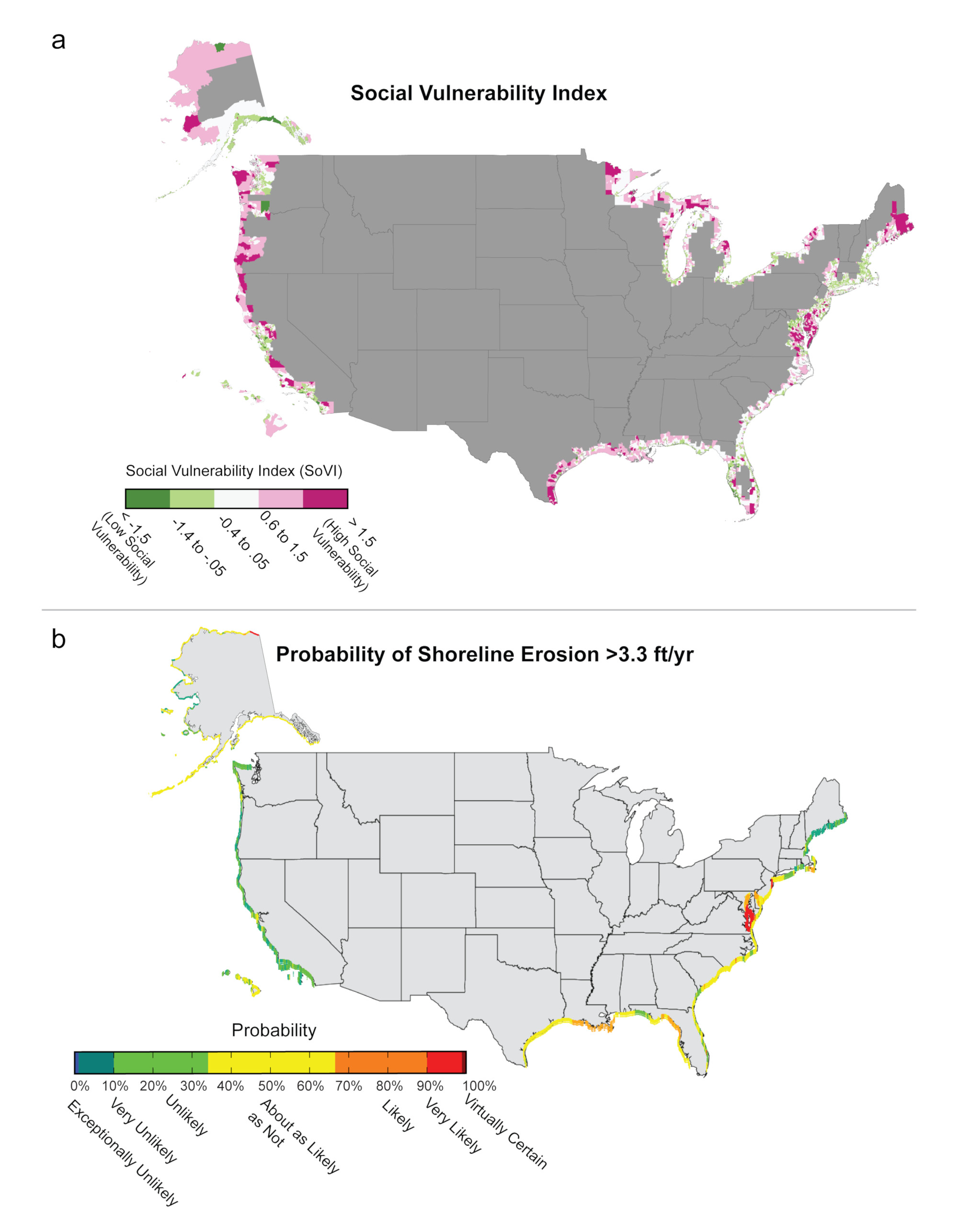
- Social Vulnerability: Social Vulnerabilty Index (SoVI) at the Census tract level for counties along the coast. The Social Vulnerability Index provides a quantitative, integrative measure for comparing the degree of vulnerability of human populations across the nation. A high SoVI (dark pink) typically indicates some combination of high exposure and high sensitivity to the effects of climate change and low capacity to deal with them. Specific index components and weighting are unique to each region (North Atlantic, South Atlantic, Gulf, Pacific, Great Lakes, Alaska, and Hawaii).
- Shoreline Erosion: Probability of Shoreline Erosion greater than 3.3 feet per year for counties along the coast. Probability is based on historical conditions only and does not reflect the possibility of acceleration due to increasing rates of sea level rise.
All index components are constructed from readily available Census data and include measures of poverty, age, family structure, location (rural versus urban), foreign-born status, wealth, gender, Native American status, and occupation.